Using a Garmin Navigation Device
Most of our group use one of the family of Garmin gps units, so the following comments refer to Garmin units and may not apply to other makes.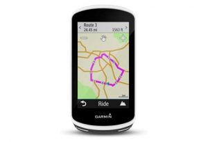
A GPX file contains information (in xml format) for navigation, which comprises waypoints, routes and tracks. More information can be found on the official GPX website.
The TCX format is also an xml format, but was created by Garmin to include additional data with each track point (e.g. heart rate and cadence) as well as a user defined organizational structure. The format appears to be primarily used by Garmin’s fitness oriented GPS devices. The TCX schema is hosted by Garmin.
Many of the dozens of other formats can be converted into GPX or TCX formats using GPSBabel.
A waypoint is a single point, for example the all important café stop.
A route is a sequence of points to be followed. It contains no elevation, or timing information.
A track is a sequence of points with optional elevation and time data. If the track has been recorded during a bike ride, each point will be stamped with the date and time when the point was recorded and the elevation, or height above sea level.
A course is a description used by the Garmin Edge family for a route, or track that has been processed by the gps unit. When a gpx file containing a route, or a track is copied into the New Files folder of your Garmin Edge unit it is automatically processed into a ‘course’, adding the turning instructions displayed as you progress on your journey.
Elevation profiles – when a gpx file with elevation data is used, the displayable profile on your gps will show the elevation profile of the ride so far and also the profile of the journey ahead. If no elevation data was present only the profile so far will be displayed.
Using a micro SD card can help with the use of memory in a gps with limited internal memory. If you need to store map background files for several countries you can use a micro SD card, 4Gb or bigger. To initialise a new card, install it in the gps unit and switch on the gps, which will automatically create the required folder structure.
A Map backgound file is stored in the Garmin folder with the default name ‘gmapsupp.img’. It may be renamed to something more meaningful e.g. England.img; any name may be used, but it must have the suffix ‘.img’. Thus multiple .img files may be stored on the gps. Either the Garmin folder in the internal memory, or on the SD card may be used, but it makes sense to use the SD card to free up internal memory for recorded tracks.
Prolonging battery life – The most common cause of batteries running out of power before a ride is completed is having the background light level too high. Lowering the backlight setting will extend the battery life.