Concerns have been expressed about the temporary alterations to the Kenilworth Greenway due to HS2. See this facebook post and also this one.
The temporary paths will probably be in place until HS2 is in operation, perhaps 2030 or later. Once HS2 is in operation, a permanent replacement will be opened parallel to HS2, on its south side between Burton Green and Berkswell station.
Make any comments you have on the “temporary” path between Kenilworth and Hob Lane to Warwick District Council. Search for reference W/20/1978/HS2
For the “temporary” path between Hob Lane and Berkswell station, send comments to Solihull Metropolitan Borough Council. Search for reference PL/2020/02821/HS2DIS
In February, Warwick District Council called for a re-evaluation of the proposed link road from the A46 Stoneleigh junction towards the University of Warwick. Details
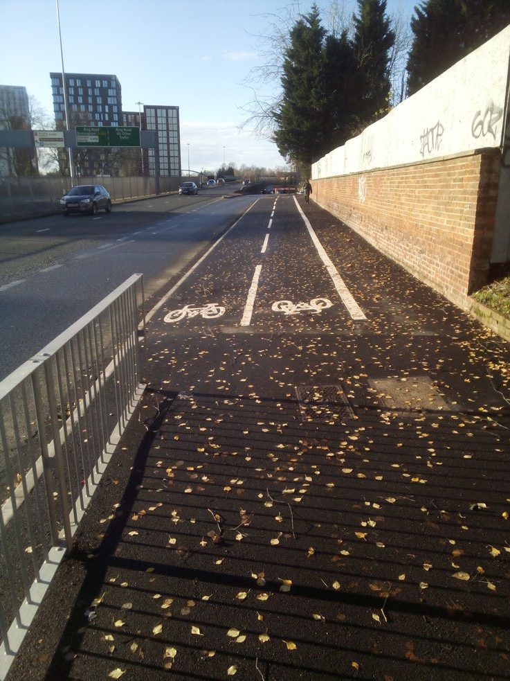
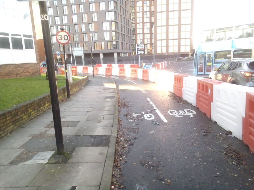
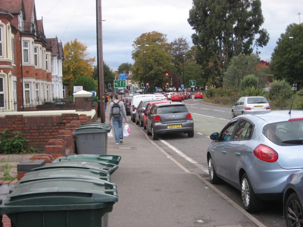
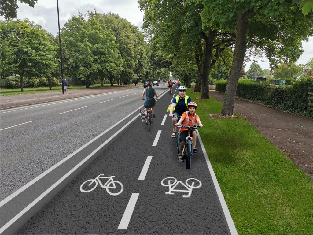
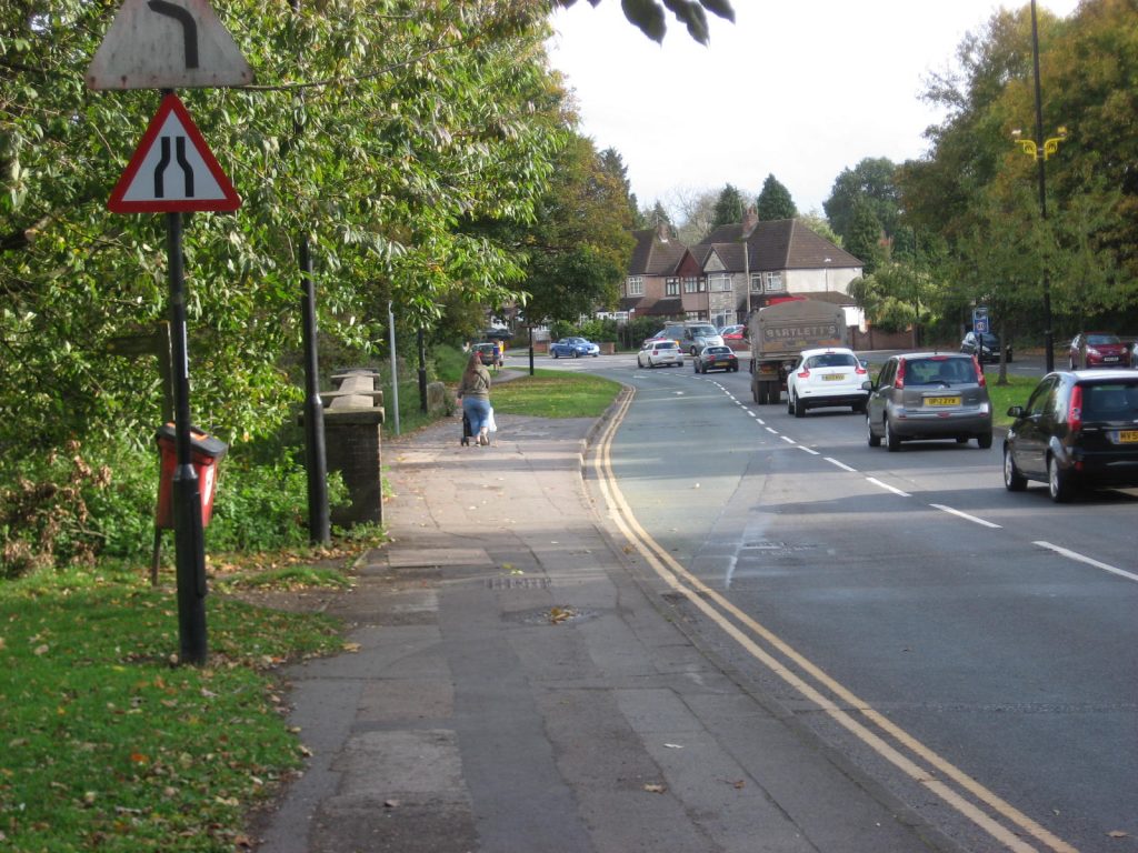
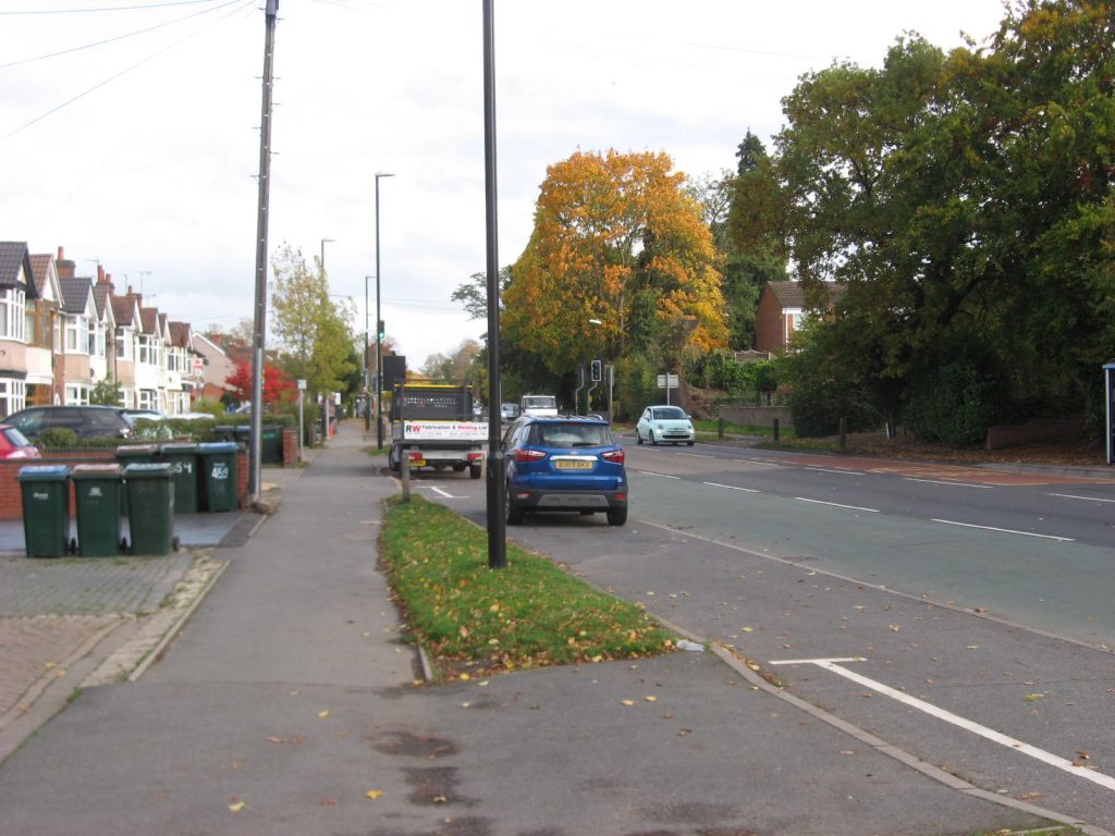
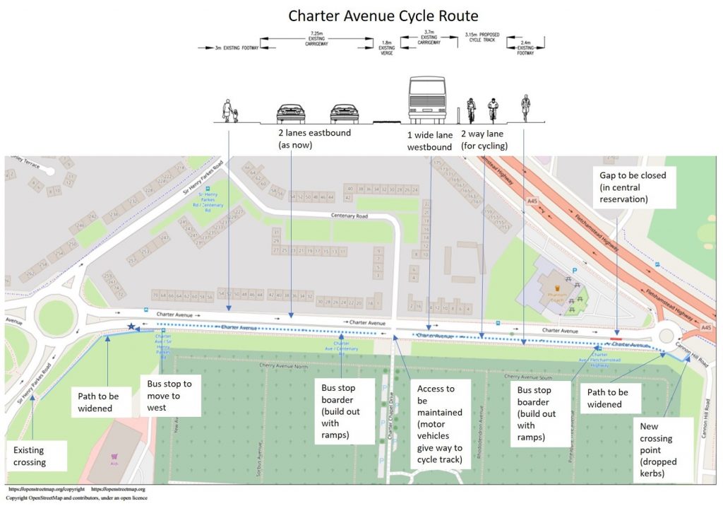
As part of the Emergency Active Travel measures, a cycleway has been created on Charter Avenue, Coventry.
It takes one of the two lanes on the southern carriageway, between Fletchamstead Highway and Sir Henry Parkes Road. flickr diagram
A request from Adam Tranter, Bicycle Mayor for Coventry
I’ve been made aware of a small number of complaints being made to the Council about the pop up cycle lane on Charter Avenue. I don’t want to give these complaints any more air time and it’s really only a handful of emails, but it’s concerning because, as you may have seen elsewhere in the country, cycle lanes have been removed because of disquiet from a noisy minority. I’d like to try and turn this into a positive conversation.
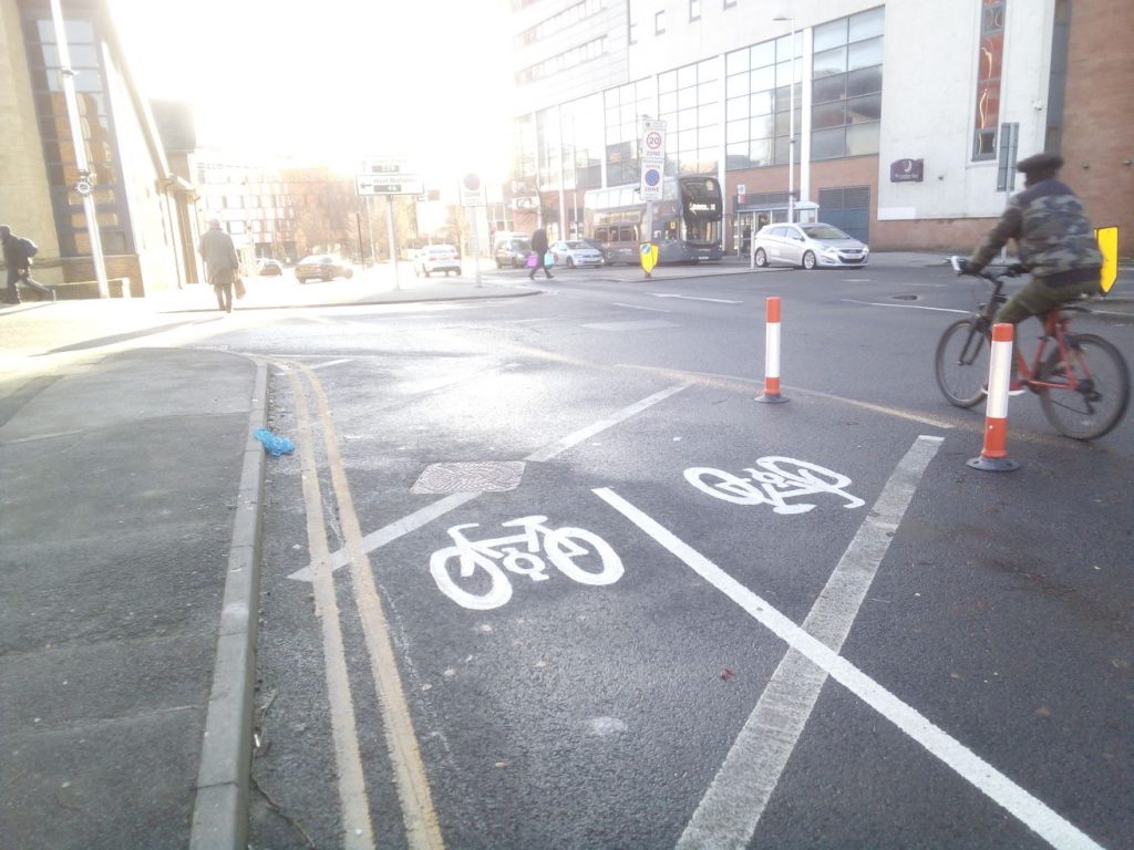
Charter Avenue was funded with the government’s Emergency Active Travel Fund to build using temporary materials, as quickly as possible, something to support those who normally rely on public transport and to prevent a car-based recovery during a respiratory pandemic where air pollution has been shown to increase the COVID-19 death rate.
I’d be the first person to say that it is not a flawless piece of infrastructure but it does provide protection from general motor traffic and is the start of an important network link in Coventry between the city centre and Warwick University. It has been poorly communicated, but the plan is to soon connect this cycleway with a new dedicated cycleway on Lynchgate Road providing an important connection to the University campus and the surrounding area.
The complaints about the cycle lane are based around the assumption that it “will cause” or “already causes” congestion. There is no evidence for this and it comes from the frequent misunderstanding that removing road space will result in the same number of cars being congested within a smaller space. Whereas in fact, if you reduce capacity for cars and make other options more attractive, you can reduce motor traffic overall through traffic evaporation. We’re in winter and there is a lockdown, but the lane remains fairly well used. Every time I’ve used it, I’ve shared the journey with 3-4 other cyclists. Furthermore, the Council have confirmed to me there are no issues with the road network load in the area – so the congestion suggestion is unfounded.
Needless to say, if complaints gain momentum and the temporary cycle lane is removed, then plans to extend through to the University become unstuck. The Council would like to make the Charter Avenue cycleway permanent in time using a more detailed, high-quality and integrated design (with things like bus stop= bypasses). If the lane goes, for any reason, we lose the chance to make it permanent. Having any cycleways removed also sets a dangerous precedent in the city that could set back future cycleway plans, just as we’re starting to get momentum.
So, I need your help. Councillors only ever really receive correspondence about complaints and I would be very appreciative if you could share your support for the Charter Avenue pop up lane so we can make sure they know the community appreciates it, and would like even more.
If you live or work in Coventry, please email Cllr Patricia Hetherton, Cabinet Member for City Services (including the Highways brief): patricia.hetherton@coventry.gov.uk. Cllr Hetherton has shown real passion and commitment so far in wanting to build more cycling infrastructure and your support will help her continue to be bold.
If you also live or work in the direct vicinity of the lane, please also email your local Ward councillor.
It is always more powerful if the emails come in your own words, but here are some points which might be helpful:
Coventry is starting to build new protected cycle lanes and this is welcomed. You’d love to see more and see a genuine cycle network form.
Your (hopefully positive) experience of using the lane.
The Charter Avenue pop up bike lane is an important link and it should be extended to the university and made permanent and future proofed.
You have seen a huge increase in people cycling during the pandemic and the only way to lock this behaviour change in is to give people safe places to cycle.
The lane will, in time, help the thousands of students who travel by bike in and around Warwick University – it’s unlikely these students will write to the council but are appreciative all the same.
Friends and family tell you that to start cycling, they’d need to feel safe. We only stand a chance of reducing congestion and improving air quality if we give people choice.
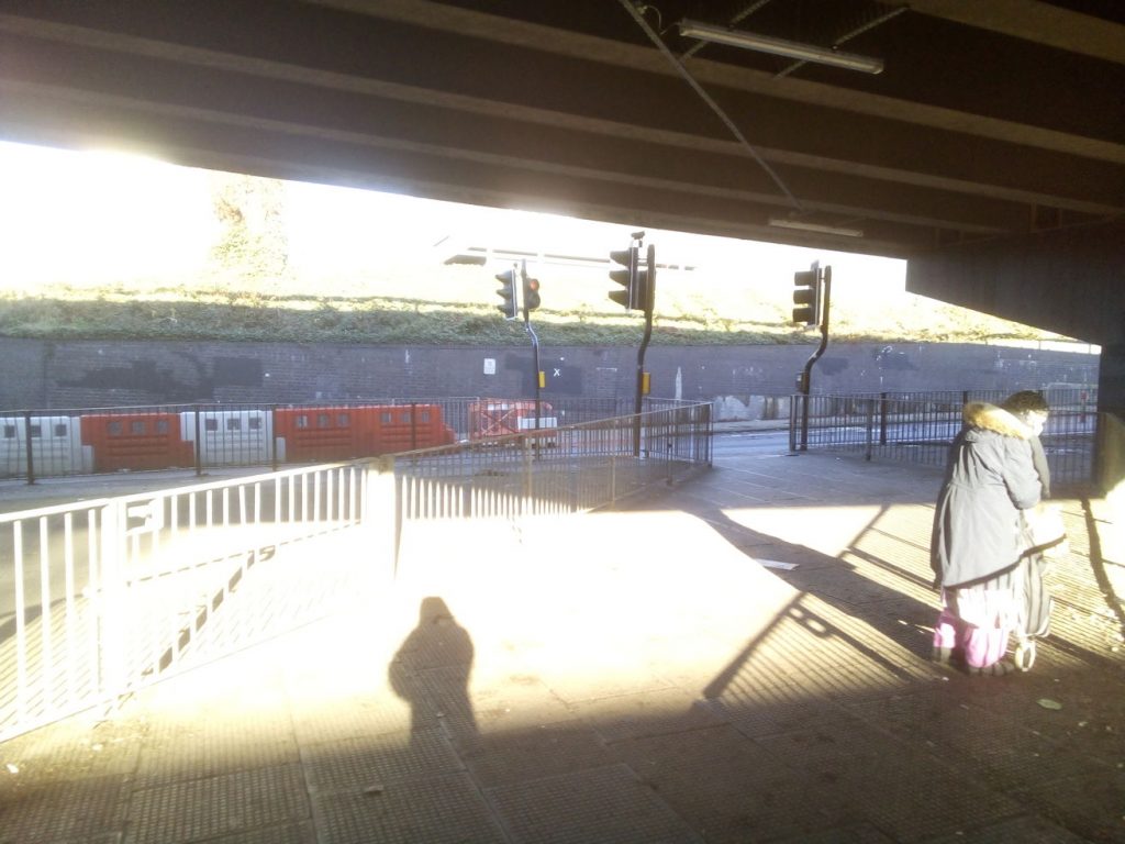
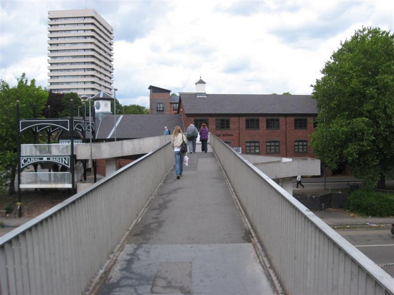
There’s long been a problem with getting between Coventry’s canal basin and the city centre.
Some people used the bridge between Bishop Street and Leicester Row to cross the ring road. That’s too narrow to wheel a bicycle, let alone pedal one!
In the past there was a suggestion to put a toucan crossing on the ring road itself. Or to raise the ring road surface by a metre or so and fit a subway under the roadway.
A somewhat cheaper option has now been implemented. Starting at the canal basin end,
space for cycleway has been created by taking one of the two general traffic lanes used to access the clockwise ring road.
The route then uses the existing pedestrian crossing to go under the ring road.
On the inside of the ring road, a lane has been taken from general traffic to make a two way cycleway separated from pedestrians:
The cycleway ends at Lamb Street. Much of the car traffic turns left here to access the West Orchard car park.
Note the cyclist on the carriageway. Cyclists coming from Radford Road will find it inconvenient to access the cycleway; they may well find it easier to take the route motorists would.
View from the south. Cyclists willing to access the canal basin must cross Upper Well Street to reach the new cycleway.
Coventry Council was (October 2020) consulting on building a Binley Road cycleway between the city centre and University Hospital. The cycleway will be segregated from both pedestrians and motor vehicles.
Phase 1 covers the 2.1 miles between the Gulson Road / Binley Road junction and the Clifford Bridge Road / Brinklow Road / Brandon Road junction.
Money has also been obtained for later phases – extending to Coventry University at one end and the hospital at Walsgrave at the other.
The council’s plans can can found at https://letstalk.coventry.gov.uk/binleycycleway. Comments will be accepted until Sunday 31 October 2020. Please complete the survey if only to say that you support the idea of cycleways segregated from both pedestrians and motor vehicles.
Overview
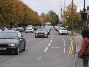
The existing cycle lanes were installed in the 1990’s. Judging by the pitifully low number of cyclists using them, there’s no doubt they are just not good enough.
The cycleway will be only on one side of the road with the space coming from the removal of the existing 150cm wide cycle lanes.
Key to council’s plans
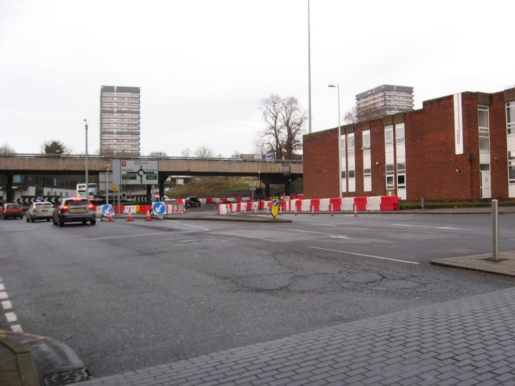
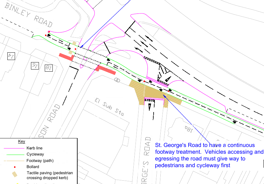
Gulson Road junction
It’s pretty heavily trafficked.
The cycleway will run (approximately) through where the traffic sign currently stands. The footway and cycleway will be raised as they pass by St. George’s Road, to indicate that people walking or cycling along Binley Road have priority. There will be a pedestrian/cyclist phase at the traffic lights.
Gulson Road junction proposals – from sheet 1 of the council’s plans
Space for the cycleway will be made by shifting the car parking northwards, taking the place of the bus lane (coloured green).
As the bus lane is 310cm wide, the extra space won’t be quite enough for the cycleway (300cm) and a “open car door zone”. Can the central reservation be shifted northwards? The 150cm cycle lane on the north side of Binley Road is no longer needed.
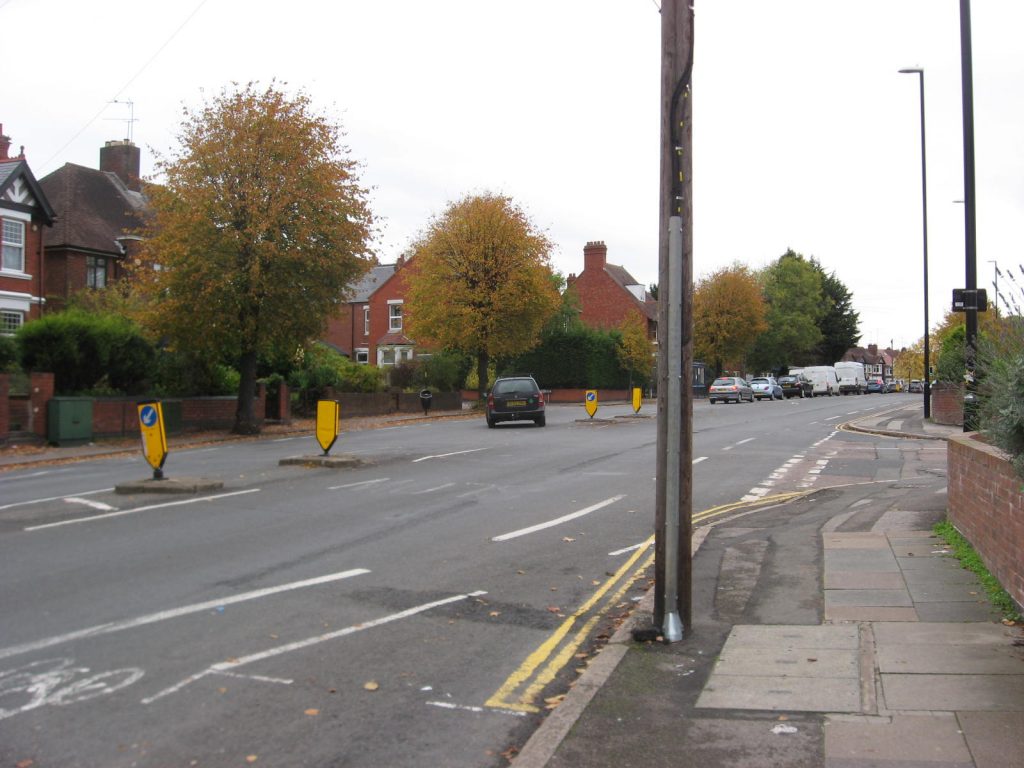
Humber Road roundabout
The existing shared use path will be replaced by a cycleway, with a pedestrian path on its south side. The clear height difference between the cycleway and the footway should make the appearance of pedestrians or cyclists on the wrong side of the division a thing of the past.
Crossing Humber Road – from sheet 2 of the council’s plans
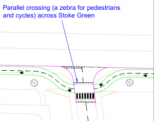
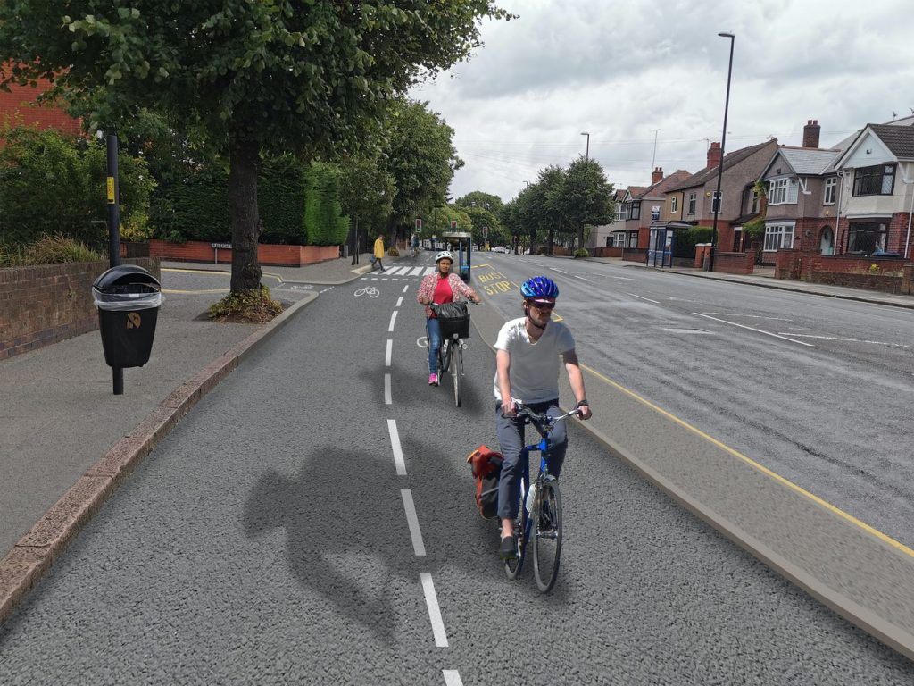
Stoke Green
The bus stop (and litter bin!) will be moved about 3 meters to the left and placed on a sort of island between the carriageway and the cycleway. Access from the footway via a “mini zebra” crossing.
This road will be blocked to motor traffic.
A computer generated image of the cycleway on Stoke Green
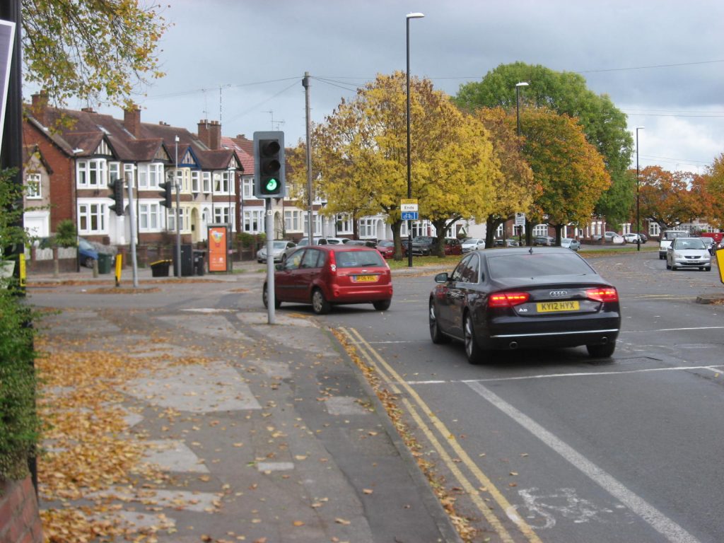
This is quite a busy junction with sometimes four or five vehicles queuing to go both in and out at peak time. Since the installation of speed cameras on this stretch (30 mph), motorists on Binley Road seem much more willing to stop to allow other drivers to exit/enter Stoke Green.
Stoke Green junction – from sheet4 of the council’s proposals
In the plans, cyclists coming from the city will be positioned just to the left of the solid white line. The cycleway will swing to the right to allow space for motorists to wait for approaching cyclists after entering the side road. Motorists waiting to enter Binley Road will also have space to wait.
Is there really enough space for the two straight-on traffic lanes and the turn right lane? At the moment outbound motorists must cross into the outbound cycle lane to get past motorists waiting to turn into Stoke Green.
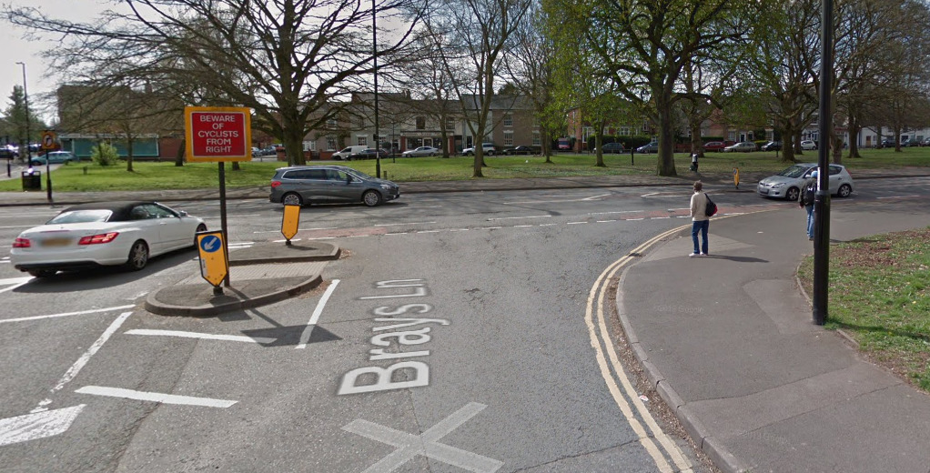
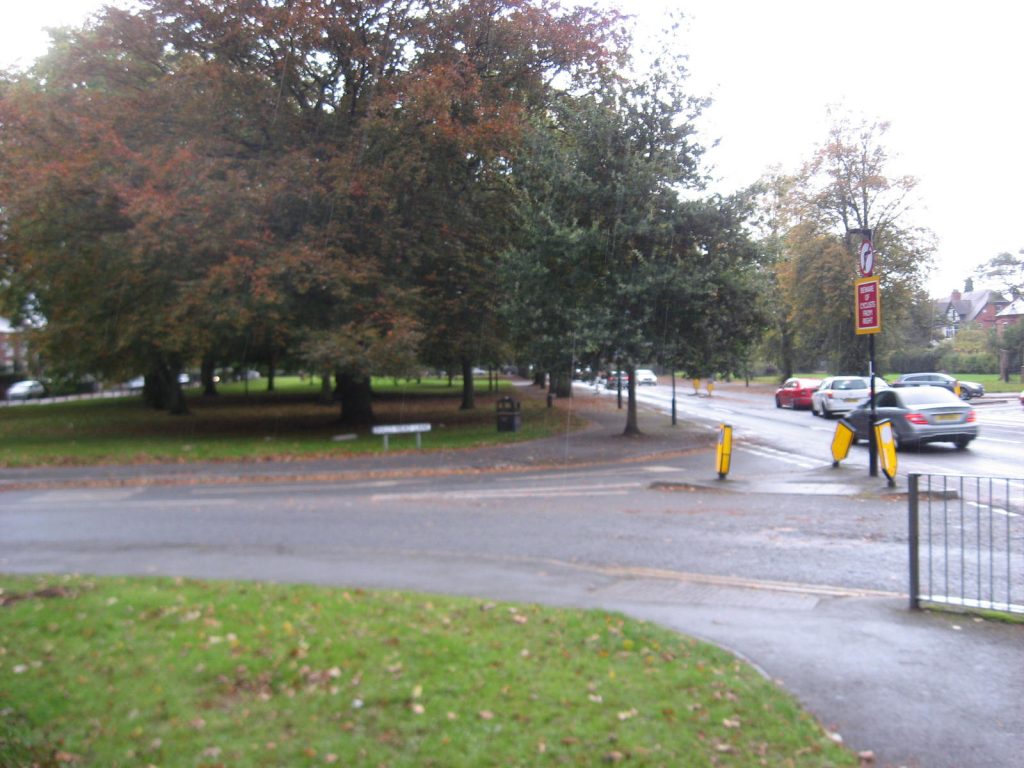
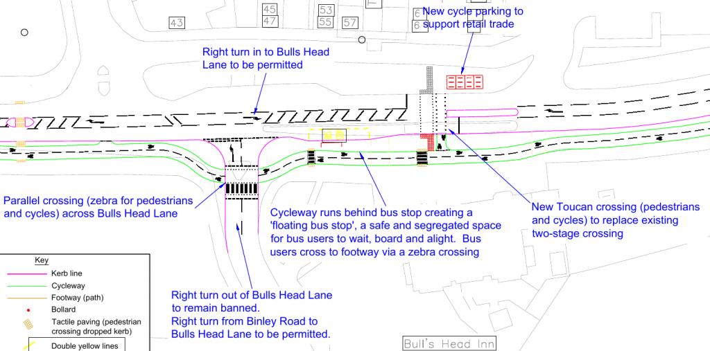
Brays Lane and Bulls Head Lane
At the moment many people cycling from Brays Lane use the pedestrian refuge to turn right, the proposals don’t make that manoeuvre any easier.
As with the previous side road, there will be a Zebra crossing here, with a parallel crossing for the cycleway.
Bulls Head Lane
Bulls Head Lane / Bray’s Lane junction – from sheet 5 of the council;’s proposals
Bulls Head Lane to Biggin Hall Crescent
View eastwards from filling station exit
The parking on the south side of the road will be shifted northwards.The width currently used by the cycle lanes will be used for the cycleway. So motorists entering and leaving the filling station or cricket club car park should have a good view of what’s coming on the cycleway and give way.
But won’t motorists be too interested looking for a gap in oncoming traffic to worry about cyclists coming from behind or front? Suppose a parked high sided vehicle obstructs the view?
There needs to be enough room for the unexpected opening of car doors as well as the cycleway and footway.
Biggin Hall Crescent will be made exit only for motor vehicles. It will be legal for people on cycles to both leave and enter.. There will be traffic lights as well.
The cycleway switches from the south side of Binley Road to the north here
Biggin Hall Crescent junction
From Coventry Council’s consultation document, sheet 6.
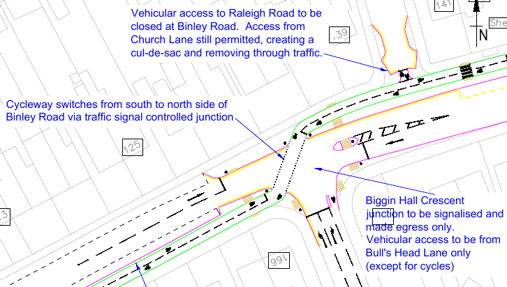
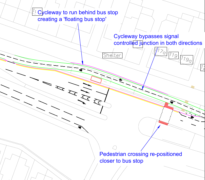
Biggin Hall Crescent to Momus Boulevard
A computer generated image of the cycleway at Raleigh Road.
Raleigh Road will be blocked for motor vehicles. People on pedal cycles will be able to legally leave and enter.
A significant proportion of the traffic turns left here (40%?)
With the new traffic signals at Biggin Hall Crescent there will be two sets in short succession. Will they be synchronised? Will cyclists wanting to go straight on be held up by a constant stream of left turning traffic?
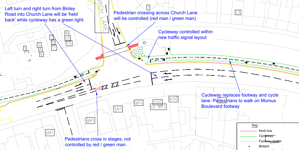
Church Lane junction
From Coventry Council’s consultation document, sheet 7
The proposals show the cycleway replacing the footway on Binley road’s north side. Wouldn’t it be better to use Momus Boulevard? It’s a very quiet road as it’s a cul-de-sac. 100% car free cycle routes are impossible – people have to get from their homes to the cycleway!
Perhaps the money saved by using Momus Boulevard (moving kerbs is expensive) could be diverted to making the nearby routes more cycle friendly? Cyclists will need to use such routes to access the new cycleway.
Church Lane to Brindle Avenue
The main points:
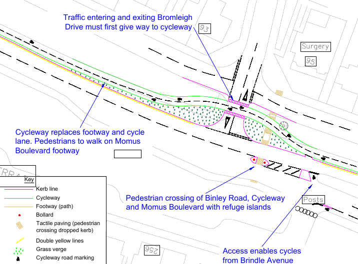
Closure of Anthony Way link between Momus Boulevard and Binley Road
Cycleway replaces footway on Binley Road’s north side (I think it would be better to use Momus Boulevard and Swinburne Avenue)
Bus stops moved out, to a position between cycleway and carriageway, with “zebra” crossings over cycleway
At Bromleigh Drive, the cycleway will go behind the traffic waiting to enter Binley Road. Wouldn’t be easier if the cyclists used Momus Boulevard and Swinburne Ave, with traffic on those roads (cycles or motor vehicles) having priority over Bromleigh Drive?
Bromleigh Drive junction
From Coventry Council’s consultation document, sheet 9.
The kerbline on the north side of Binley Road is to be moved south. 3 metres?
Eastbound, the point where the single general traffic lane is increased to two lanes will be moved closer to the Brindle Road traffic lights. The point where the eastbound carriageway is expanded to three lanes will also be moved eastwards, closer to the Hipswell Highway junction. That space was created as a bus lane a few years ago and subsequently given over to general traffic.
Presumably cyclists from the city centre, who want to turn into Brindle Ave, will exit the cycleway just past Bromleigh Drive and then use the general traffic lanes to make the right turn. Pity that currently the signals do not seem able to detect cyclists!
Presumably cyclists from the east, who want to turn into Brindle Ave, will use the Toucan crossing to make the turn.
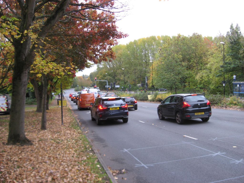
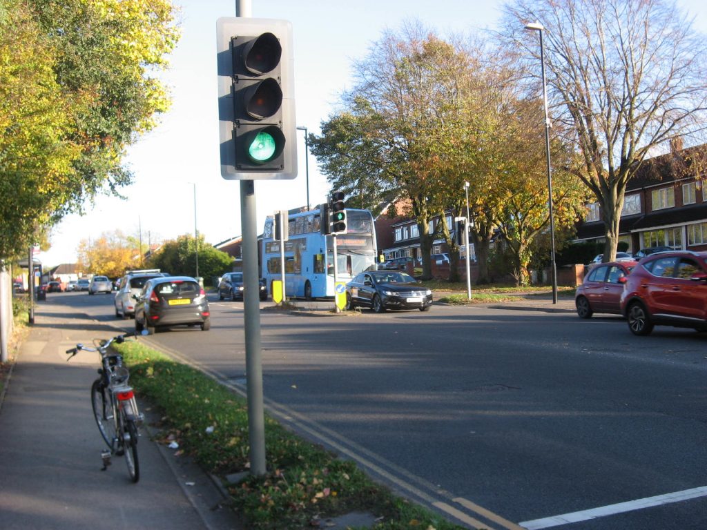
Brindle Avenue to Hipswell Highway
Traffic queuing on city (west) side of Hipswell Highway / Allard Way junction
About 100-150cm will be taken from the grass verge to provide the cycleway. A new verge will be planted between the cycleway and carriageway further west (up the slope).
Hipswell Highway / Allard Way junction – from Coventry Council’s consultation document, sheet 11
Will the approaching cyclists be detected before they arrive at the junction and taken account off? Or will the cyclist phase be fixed? Or only generated if a cyclist stops and presses a button?
I’m often surprised at the number of cyclists crossing between the footway on the west of Allard Way and Hipswell Highway. Could this movement be made easier? A cycleway on the west side of Hipswell Highway would be irrelevant.
Constructing a cycleway on the west of Allard Way between Binley Road and Second Avenue would be good. Coventry council made plans to build a cycle path between Yew Close and Allard Way (near railway bridge), alongside the river, in about 2007. Could these be revived to complete a link along Allard Way? The link between Yew Close and Ashdown Close could be improved (anti motorcycling barriers revised) to provide a link between the Binley Cycleway and Ernesford Grange / Willenhall.
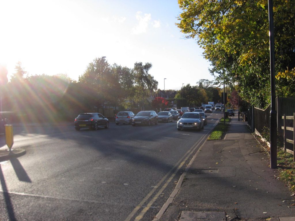
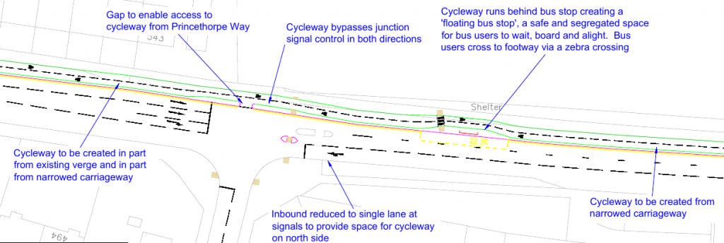
Hipswell Highway to Princethorpe Way
About half the space for the cycleway will be taken from the verge and the rest from carriageway.
Binley Road at River Sowe bridge
Binley Road – 100m west of Post Office
The cycleway will use the lay-by space.
Given that there are shops nearby, there may be a problem of vehicles parked on the footway or cycleway. Perhaps bollards along the cycleway’s kerb would provide a solution,
The kerb will be moved 1-2 meters to the right, the bus shelter will be moved close to the new kerbline and the cycleway will go behind the bus shelter.
Bus stop “Binley Rd Post Office”
Tree just east of “Binley Rd Post Office” bus stop. Proposed to fell and replace with another closer to the houses.
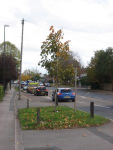
Tree on approach to Princethorpe Way junction. Proposed to fell and replace with another closer to the houses.
Little help is proposed for people cycling to/from the Ernestford Grange area; the estate to the left in the image.
This limits the potential for hospital workers living in the area to switch to cycling their commutes.
Princethorpe Way to Clifford Bridge Road
Princethorpe Way junction. From – from sheet 15 of the council;’s proposals
One lane from the other side of the road will be removed to allow space for the cycleway on the left (north) side.
Brandon Road junction
From sheet 16 of the council’s proposals
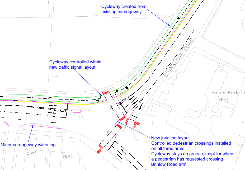
Clifford Bridge Road junction
From sheet 17 of the council’s proposals
The facility on the east side of Brinklow Road appears to be shared use. That’s against the latest Department of Transport recommendations. It limits the possibility of using Harry Weston Road to access the shopping area and housing estate to the east (Skipworth Road).

 That’s too narrow to wheel a bicycle, let alone pedal one!